vancouver bc traffic
 

Vancouver BC Traffic Reports
Maple Ridge - Pitt Meadows
Highway 7 heading West

Drivers of Maple Ridge BC and Pitt Meadows. Use these Pitt Bridge traffic cameras to plan a less stressful drive. Big delays? Leave your home earlier. Check before you leave your home then you won't be stressed out seeing long waits to cross Pitt River Bridge. Driving around Vancouver BC means bridge traffic and overall frustration. The BC provincial government invested in traffic cameras to save you time and hassle. Why not use what is there for us? Vancouver and Pitt River Bridge traffic Images and page will no longer automatically refresh. Click on your browser refresh button for the most updated traffic cameras and information!

Counter-flow schedule:
From: 5:30 am – 9 am
3 lanes westbound; 1 lane eastbound
From: 3:30 pm – 6:30 pm
3 lanes eastbound; 1 lane westbound

Pitt river bridge traffic cams current conditions:

Hwy 7 Dewdney Trunk and Kennedy Rd
Pitt River bridge East side camera - Maple Ridge
Pitt River bridge West side camera - Maple Ridge BC
Mary Hill Bypass at Lougheed Hwy - Pitt Meadows
Lougheed Hwy looking west - Maple Ridge BC

vancouver pitt bridge traffic

pitt river bridge


Click for the latest Vancouver weather forecast.


vancouver traffic updates

maple ridge pitt bridge traffic Looking East on Lougheed Hwy at Kennedy Rd - Zoomed Viewmaple ridge pitt bridge traffic

vancouver maple ridge traffic reports


maple ridge pitt bridge traffic Looking East on Lougheed Hwy at Kennedy Rd - Pitt Meadowsmaple ridge pitt bridge traffic

pitt river bridge conditions


Looking West on Lougheed at West side of Pitt River bridge maple ridge pitt bridge traffic

vancouver pitt river bridge cams


Looking South on Mary Hill Bypass, Hwy 7B, Pitt Meadows

pitt river webcams


Daily Driving Tip

U-Turns at Traffic Lights


DriveSmartBC
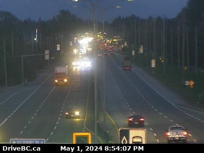
Intersections with traffic lights are the busiest and most controlled areas that we travel through as we drive on B.C.'s highways. They are also the most dangerous, because in 2002 more than 42% of collisions occurred at these locations. If you lose your way, making a U turn here is not an option.


pitt river bridge maple ridge

Pitt River Bridge

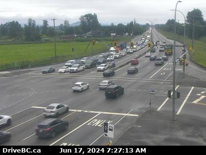
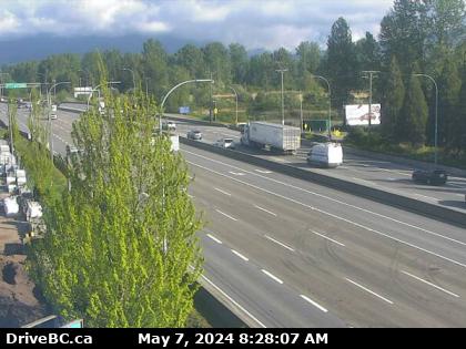
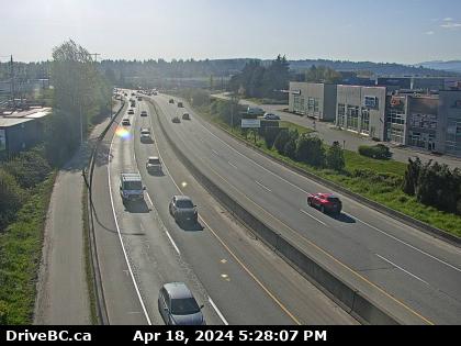
The Pitt River Bridge.The Pitt River Bridge, opened in 1957, crosses the Pitt River in British Columbia, Canada, connecting Port Coquitlam to Pitt Meadows. The bridge has a mid swing span that is controlled by a control house. Sadly or not so sadly, Maple Ridge BC and surrounding area will be getting a new Pitt River Bridge and Mary Hill Bypass interchange. Don't worry, you will still need Vancouver traffic cameras! At least though, your Vancouver traffic will be lessened.

If you live in the Maple Ridge or Pitt Meadows area of BC, then you know all about the hassles crossing the Pitt River Bridge. Well, let us help you! Save yourself time by avoiding Pitt Bridge Traffic delays. View the Pitt River Bridge raffic cameras to see the traffic delays with your own eyes. With cameras, it's much easier to make a decision on where and when to go. Our goal is simple. We want to provide you with instant visual Pitt River Traffic conditions in two clicks or less! No visiting multiple pages. Remember we are your #1 lower mainland BC traffic cameras resource! Thanks and please visit us again!


Home - Our Topical Vancouver Blog - Bookmark This Page - Contact Us - Advertising Inquiries - Privacy Policy - Page Top

Quick Links for more Vancouver Traffic Cams:

Downtown Vancouver BC traffic heading South
Downtown Vancouver road conditions heading North
Downtown Vancouver heading over Port Mann Bridge East
North Vancouver Second Narrow Bridge and West Vancouver heading South
Highway 1 heading east and west lower mainland traffic
Highway 7 heading west traffic pitt river bridge
Highway 7 heading east lougheed hwy traffic
Surrey traffic
Peace Arch Border
BC Ferries waits

vancouver bc drive bc logo maple ridge pitt bridge traffic